A long day from Sechelt to Saltery Bay
I updated the previous post with some photos of my ride from Vancouver to Sechelt so check it out.
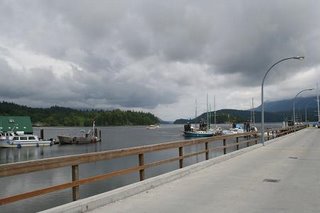
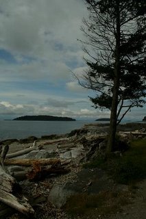
Where to begin. I really have large backlog of days to describe as it has been a while since I was last at a computer I could upload photos to. First I have some photos of the little town of Sechelt, gateway of the Schelt Peninsula where I was staying at small hostel after my first day of riding from Vancouver. Below and to the left is a photo of the Sechelt Inlet on the West side of town and the one on the right is of the ocean side to the East.
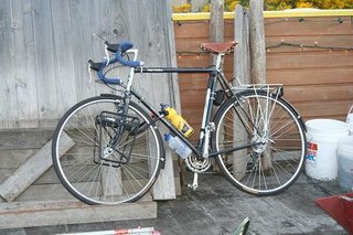
Below a picture of my trusty steed the Centurion ProTour 15.
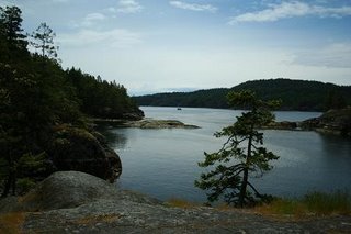
After an early start from Sechelt I made my way north along the Canadian 101 for about 20 miles before taking a side trip off the main route to Smuggler's Cove, which was first used to smuggle Chinese laborers into the U.S. after the completion of the Canadian railway, and later during Prohibition to smuggle Rum to thirsty Americans. I had my lunch out on a great sunny boulder and spied my first bald eagle and what I believe was a sandpiper. The two mile ride down a dirt trail and through some wetlands was my first off road experience with the loaded touring bike, which behaved remarkably well soaking up most of the smaller bumps and was with the added weight on the rear surprisingly hard to skid. Below to the right is a photo from my lunch spot.
After climbing back up the road to main highway I put another 20 miles in before reaching the small harbor of Madeira Park where I had a snack and stocked up on camping supplies at the grocer. I took a short rest down by the docks and here is shot of my ugly mug badly in need of a shave with the view across the water behind me.
 After another 20 miles I was about to the ferry terminal at earl's cove but I had about two hours to kill before the next ferry so I took another trip off the highway down to the Skookumchuk Narrows at the mouth of the Sechelt Inlet where the tidal force of the massive inlet results in massive reversing rapids which make boat passage only possible during the short period when the tide cycle is at crest or a trough. Below is a shot of kayaking navigating the incredible currents. Kind of small for some reason.
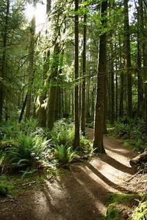
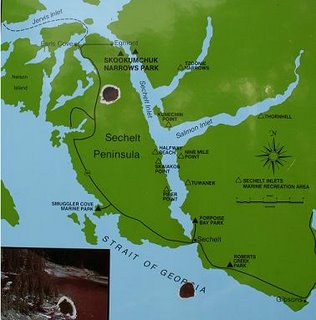
 The next photo is of the trail down to the narrows on the left and on the right an image of the map which covers pretty much the whole distance I rode today.
After delaying here for a bit too long I realized I only had about 45 minutes to bike the 7 or 8 miles to the ferry terminal. Normally not an issue as I average about 10 mph but I had covered some seriously rolling terrain to get to the narrows and I had all ready gone about 50 miles. I pushed it as hard as could only to arrive at the terminal 5 minutes after the scheduled departure. Fortunately the ferry was behind schedule and it was pulling in to the terminal just as I arrived. A real turn of luck as it was all most 7 P.M. and the next ferry was not 'til 9:30. The ferry ride from Earl's Cove to Saltery Bay was even better than the last as the sun was beginning to set and my weary legs really needed the rest.
As we left I could just make out the mouth of the Sechelt Inlet where I had been only an hour or so ago. With all this water about I begun to rethink my decision to bicycle and thought perhaps I would be better suited in a kayak. As we neared the Saltery Bay terminal the fires lit by the logging industry added a warm hue to the setting sun over Texada Island(below). 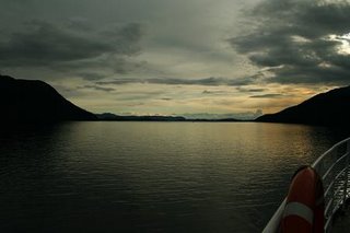 I was much relieved when the camp site at Saltery Bay Provincial Park was less than a mile from the campground. I made camp and took my stove down to Mermaid Cove where I cooked my dinner looking out across Malaspina Strait (again below).
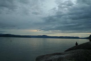
It was long after 9 when I fell asleep in my tent listening to Belle and Sebastian as the rain began to gently fall.

0 Comments:
Post a Comment
<< Home